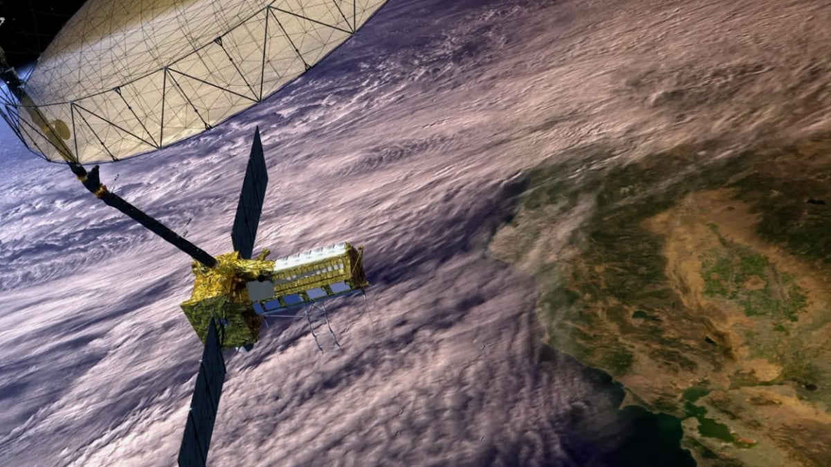
American space agency NASA and the Indian Space Research Organisation (ISRO) are scheduled to launch the NASA-ISRO Synthetic Aperture Radar (NISAR) satellite in March 2025, as per multiple reports. The mission, estimated at Rs. 5,000 crore, aims to advance Earth observation capabilities globally. Reports indicate that the satellite, weighing 2.8 tonnes, will track planetary changes with precision and will scan nearly all of Earth's land and ice surfaces every 12 days. Its dual-frequency radar technology is expected to deliver unprecedented data accuracy.
Mission Features Advanced Radar Technology
The NISAR satellite incorporates synthetic aperture radar (SAR) technology, enabling it to capture high-resolution images regardless of weather conditions or lighting. According to the official blog of NASA, its radar can detect surface changes as small as one inch and penetrate dense vegetation, making it a vital tool for mapping ecosystems and monitoring land dynamics. The dual-frequency radar combines NASA's L-band and ISRO's S-band, offering enhanced precision in data collection.
Launch and Operational Details
As per reports, ISRO's GSLV Mk-II rocket might carry the NISAR satellite into a sun-synchronous orbit from the Satish Dhawan Space Centre. Positioned at an altitude of 747 km, the satellite is expected to operate for three years, observing Earth's landforms, ice formations, and vegetation changes. It will also assist in monitoring natural events such as earthquakes, landslides, and volcanic activity.
Challenges Addressed Before the Launch
The report further mentions that the mission faced delays due to technical challenges involving its radar antenna reflector. To address these, reflective tape was added to manage temperature fluctuations. Key components of the satellite were transported from the United States to India in October 2024, completing a complex logistical process.
Impact of NISAR's Observations
According to experts, the mission's data will be instrumental in understanding solid Earth movements, their implications, and global environmental changes. Its wide-ranging applications include studying ecosystems, ice dynamics, and geological events, contributing significantly to research and disaster management efforts.


