


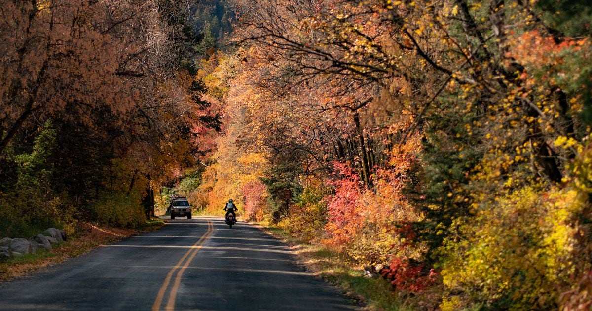
Mill Creek Canyon road could be widened from the winter gate parking area all the way up to the Upper Big Water Trailhead, according to a proposal by the Federal Highway Administration, Salt Lake County, Millcreek and other federal agencies.
An environmental assessment released in early March states that spring, summer, and fall access to the upper canyon “would be limited or restricted for the 2-year construction period.” Construction would start in May 2025.
Why can’t the upper canyon remain partially open to the public?
“The simple answer to this question is that the canyon is too narrow to safely allow heavy equipment and pedestrians,” Brock Damjanovich, communications manager for Salt Lake County Regional Development told The Tribune in an email. “In addition, a partial closure would make the project more expensive and it would take longer. We want to minimize cost and disruptions wherever possible.”
“We know that this canyon is loved by so many and really what this is about is preparing for the future,” Salt Lake County Mayor Jenny Wilson said in 2021 when the project was first announced.
Salt Lake District Bekee Hotze of the Forest Service also voiced support for the project in 2021. “Access to Mill Creek Canyon and the facilities within the canyon are deteriorating and not keeping up with the use that’s currently going on,” Hotze said. “Where feasible, the road will be widened to accommodate the multiuse that we are currently seeing in the canyon.”
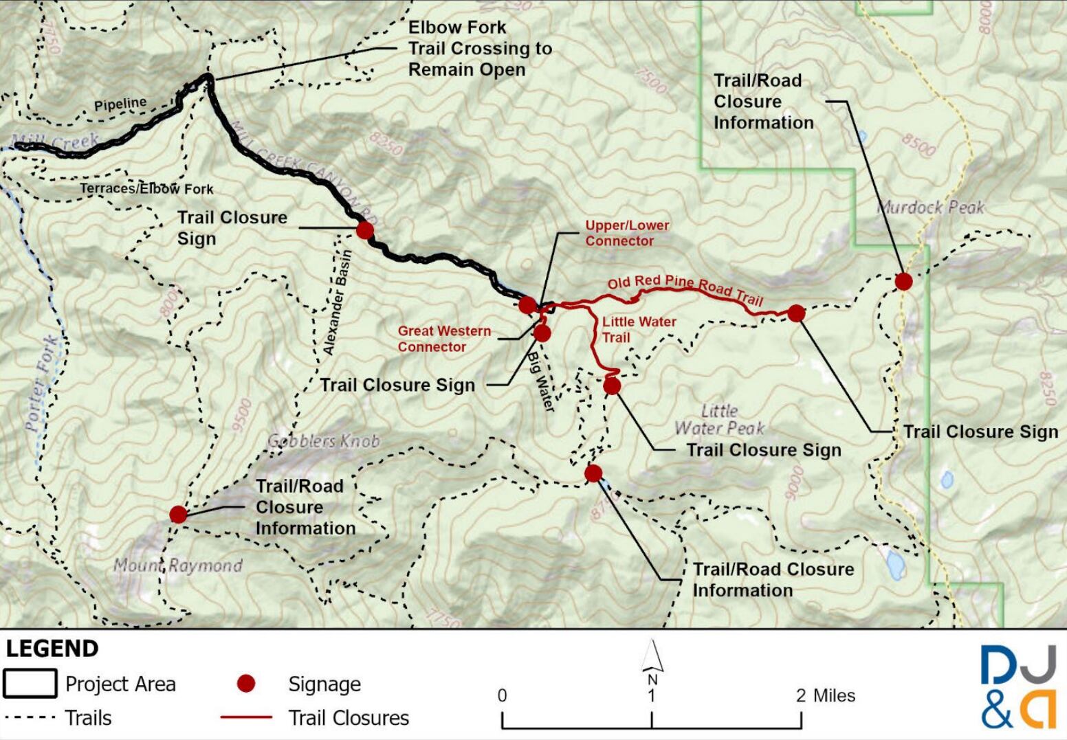
The Forest Service hopes to realign the Pipeline trail so people can hike into the upper part of the canyon during construction, but is still working to secure funds to build a needed bridge.
The upper canyon road would be accessible during the winter between Dec. 15 through March 15. The Forest Service doesn’t plan to expand the season use for the upper canyon and the upper road will still close from November 1st through July 1st each year. Nordic skiers will still get to glide up and down the road.
Other changes under the proposal:
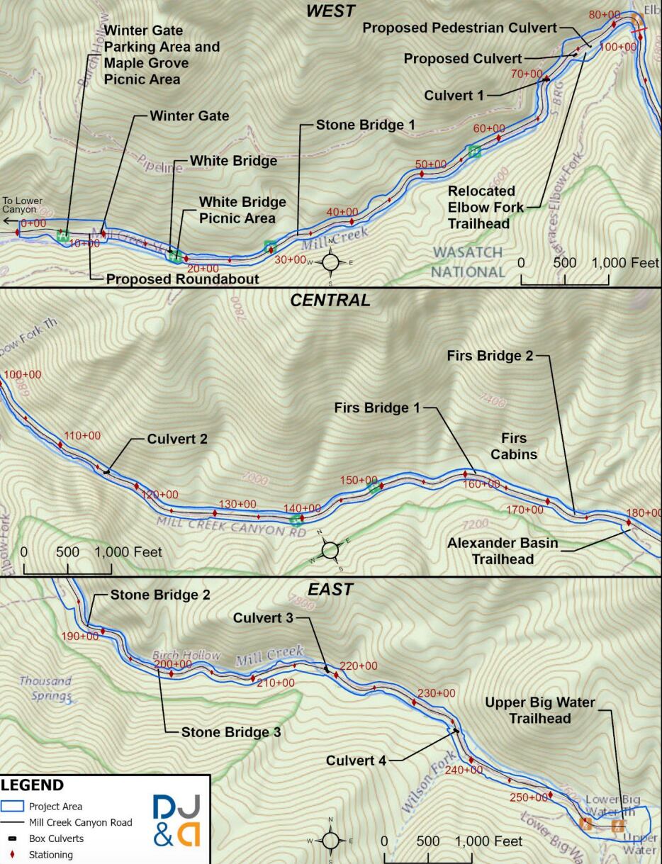
• A roundabout would be built about 250 feet east of the winter gate parking area to “provide snowplows and large vehicles with a convenient place to turn around.”
• The winter gate would be moved 200 feet East.
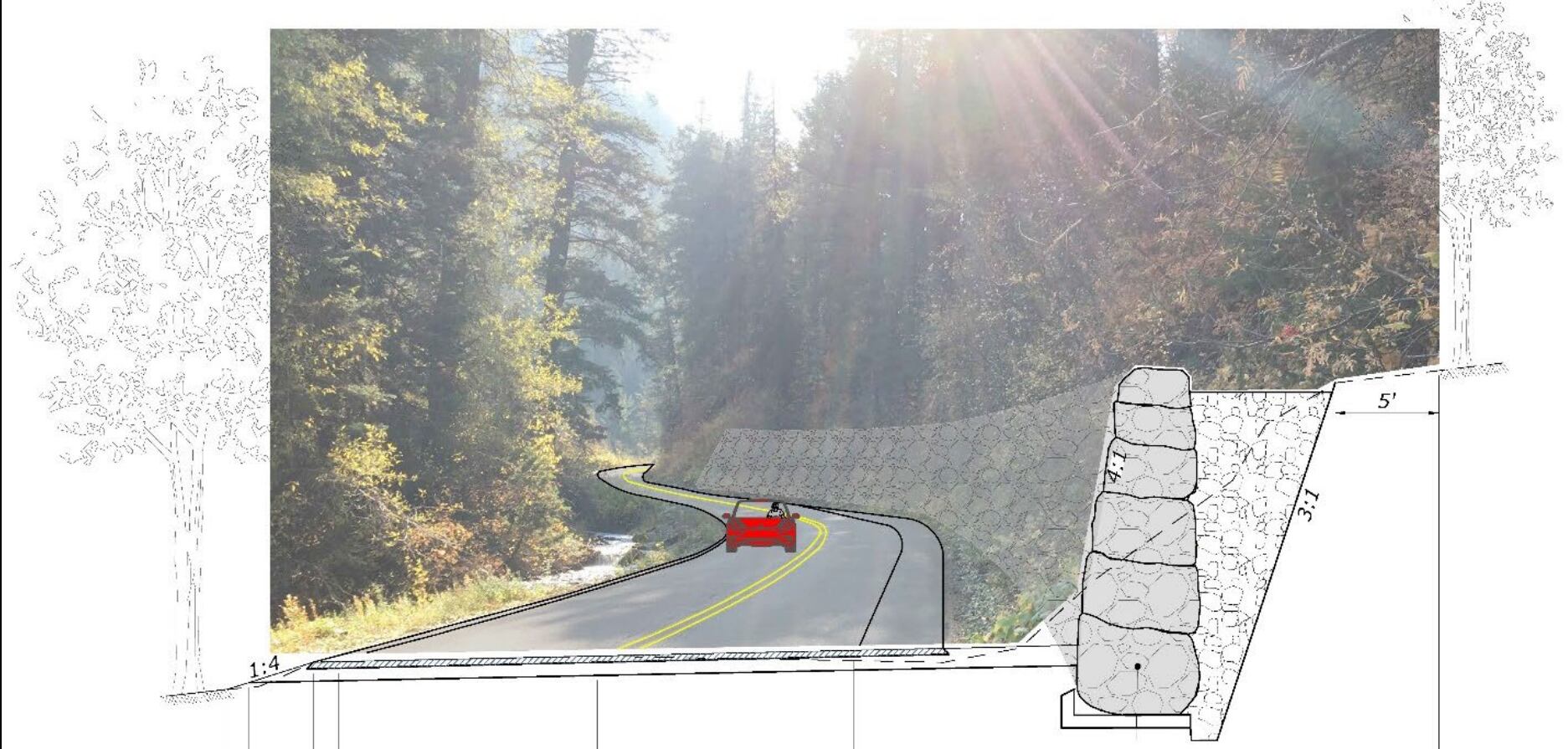
• The 1.5-mile strip from the proposed new roundabout to Elbow Fork would be widened to 24 feet (the strip currently varies from 16 to 24 feet). It would create 10-foot-wide lanes and a 4-foot-wide bicycle lane on the uphill side.
• More formal parking areas would be created and “informal” ones removed. The report estimates that the total parking capacity will remain about the same through these changes.
• The Upper Big Water Trailhead parking area would be expanded from .36 acres to .84.
• Crosswalks and signs would be installed in areas where people frequently cross to access trails.
What are the impacts?
Trees would need to be removed in some areas, and the loss of streamside vegetation to replace culverts “could have other effects to water quality and aquatic species,” according to the environmental assessment.
There are three small wetlands within the proposed project area that could be impacted as well.
Plus (aside from the winter) hikers, bikers and those with dogs would no longer have access to the upper canyon during the project.
“Users travelling farther distances to reach Mill Creek Canyon could more easily choose alternate destinations with little to no adverse impact,” the EIS states. It lists City Creek Canyon as one alternative, although canyon access is limited through 2027 due to construction at the water treatment plant.
Save Our Canyons wrote on Instagram: “We believe that safety goals can be better achieved by reducing the number of personal cars in the canyon, rather than treating pavement as the solution.”
“Providing access to public lands must be affordable and efficient and we need transportation systems that work in harmony with the connected ecosystem, not more pavement,” said Spencer Shaver, the executive director of Save Our Canyons.
“Some of the improvements certainly make sense on improving pedestrian safety,” said Bike Utah planning and policy specialist Cameron Carter. “I think they are adding a bike lane to the road, which is great.”
But, Carter continued “every inch of pavement that is added to the canyon negatively affects the ecosystem, whether it’s through the watershed or by increasing emissions from vehicle travel.”
Damjanovich reiterated that “operational changes” are “out of the scope of this project” but “all the trailheads are being designed for potential shuttle/transit options.”
The public can still comment on the assessment
“We have made changes to the project based on public input and we encourage people to respond” Hotze said.
The full proposal can be found here and a story map outlining the changes to Upper Mill Creek Canyon here. The public has until April 5 to review the proposal and comment.
“This is not a comment period where the team is taking input on the project design,” explained. “They have already had three opportunities to provide comments on the project as a whole in Nov. 2021, May 2022, and June of 2023.”
Editor’s note, Thursday, April 4, 11:40 a.m.: This story was updated to include additional information from the Forest Service.


