


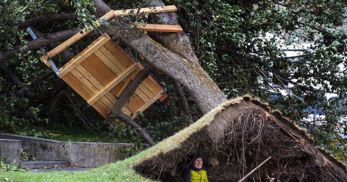
Hurricane force winds are expected to hit Davis and Weber counties on Thursday and Friday. A high wind warning is in effect until noon on Friday across northern Utah.
According to the National Weather Service, “dangerous downslope winds” will hit Davis and Weber Counties beginning mid-morning on Thursday and continue into Friday morning. Gusts between 70-85 mph are expected from Kaysville to Bountiful.
Wind speeds for a Category 1 hurricane are between 74-95 mph.
Gusts of up to 60 mph are in the forecast for the rest of Davis and Weber counties.
And in Salt Lake, Cache and eastern Box Elder counties, strong downslope winds with gusts of 50-70 mph are expected. In Salt Lake City, areas near the University of Utah, in Millcreek, and in the vicinity of Parleys Canyon will be the most affected.
The National Weather is advising Utahns to:
• Be prepared for flying debris and downed trees.
• Be prepared for power outages. (Rocky Mountain Power is reminding Utahns to “treat all downed wires as live and dangerous,” and to report power outages by calling 877-508-5088, on its website or on the Rocky Mountain Power app.)
• Be prepared for difficult driving conditions and possible road closures Strong crosswinds are expected on Interstate 15, US-89 and the Legacy Parkway in northern Salt Lake, Davis and Weber Counties, and high profile vehicles and vehicles towing trailers will be especially affected. According to the Utah Department of Transportation, it anticipates “issuing high-profile vehicle restrictions along I-15 and Legacy Parkway between Bountiful and Kaysville, as well as certain areas near Brigham City” on Thursday.
• Secure outdoor objects, including decorations, garbage cans and trampolines.
Neither rain nor snow is expected in northern Utah. In the Salt Lake City area, highs near 50 are in the forecast for Thursday; in the mid-50s Friday-Sunday; and in the low 60s Monday-Wednesday.
However, a slow-moving storm will drop “significant precipitation” on southeastern Utah through Saturday “bringing some of the most significant snow totals of the season to that area,” according to the weather service. Expect snow accumulations of 4-12 inches in the valleys near Capitol Reef and westward; 6-10 inches in the vicinity of Bryce Canyon\; and 6-16 inches in the mountains — with up to 30-40 inches Henry Mountains and around Boulder Mountain
And it will be windy in southern Utah as well, with gusts of 30-45 mph and a few in excess of 50 mph.


